| Chapter 1 | Chapter 2 | Chapter 3 | Chapter 4 | Chapter 5 | Chapter 6 | Chapter 7 | Chapter 8 | Chapter 9 |
Where in the World is Arizona?
Before you begin your journey you will need to discover where in the World is Arizona? As you move through the unit you will need to make note of the location of Arizona so that you and your team can find the area you will be exploring. You can use the notebook to make notes as you move through the unit. To access the notebook click on the notebook icon above.
Arizona is the place we call home. To us Arizona seems very large, but it is just a small part of the world. Through the study of geography we can learn about the land, water, plants, animals and people of many different places.
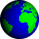
We live on the planet Earth. But just where on earth is Arizona? On a globe or world map, we can see seven large land areas. These land areas are called continents. Arizona is on the North American continent. Do you know what the other continents are?
Try this online quiz and find out!
North America is divided into countries. A country is a land area with its own government. Arizona is part of the United States. Mexico is part of North American and is located south of the United States. Do you know what country is north of the United States?
Look at the map to find the answer!
You and your team will need to be able to tell people from other countries where Arizona is. There are two ways that you can describe a location. The Relative Location tells us where a place is in relation to other places or things. For example, we can describe Arizona by telling someone that it is between California and New Mexico. You could also tell people that you live near the Colorado River or next to the school. When you describe your location this way you are using relative location.
The Exact location is the exact spot where a place can be found. When you tell someone your address you are giving them your exact location. The state of Arizona has an exact location. Do you know what it is?
Longitude and Latitude are another way of describing an exact location. They are imaginary lines on a globe or a map. These lines help people to locate a place on a map. If you were to walk over the earth you would never cross a line of longitude or latitude because they really do not exist, they are only on maps. If you look at a map or globe you will see these lines. The lines of latitude run around the earth from east to west. The equator is a line of latitude. Lines of longitude run north to south, from pole to pole. The lines of longitude and latitude cross over each other making a grid. You can use this grid to find the location of any place in the world.
Hemispheres
There is another way to divide up the earth. We can pretend that the earth is cut up into two equal pieces. Each half if called a hemisphere. We can divide the earth into two halves at the equator. The top half which is north of the equator is called the Northern Hemisphere. The bottom half which is south of the equator is called the Southern Hemisphere. We can also divide the world in half another way from the North pole to the South pole along a line that runs through the Atlantic and Pacific Oceans. North America is located in the Western Hemisphere and Asia, Africa and Europe are located in the Eastern Hemisphere.
The climate of a place has a lot to do with its location. Climate is what the weather is generally like year after year. The amount of rain or snow that falls each year is part of the climate. The usual number of days that are cold, warm or hot each year are part of the climate. What makes the climate different from one place to another?
Distance from the Equator
The closer a place is to the equator the warmer it is. The farther a place is from the equator the colder it is. That is because the sun shines most directly on the equator. So the places closest to the North and South poles are cold all year long. Places located between the equator and the poles are not always hot and not always cold.
Distance from large bodies of water
The cold water of a large body of water or a lake helps cool the land nearby. When water gets hot in the summer it helps to warm the land in the winter. Large bodies of water also affect how much precipitation (rain or snow) the land gets. This is because the water evaporates into the air, then the wind blows the moist air across the land.
Elevation
Elevation is how high the land is above the level of the ocean. The level of the ocean is called sea level. High places are usually cooler than low places. This means that the mountains are cooler than the valleys below. This is why some mountains have snow on the top all year long.
Arizona sometimes has the hottest and coldest temperatures in the United States on the same day! The White Mountains can be very cold. Desert towns along the Colorado River have hot summer days.
Nights in the desert can be cool. Clear skies let the heat float away. Nights in the big cities are warm. Pollution from cars is like a blanket that traps the heat . In the cities there are lots of cars that pollute the air. Cement, pavement and brick also hold a lot of heat that keeps the night air warm.
Rain or Snow
Arizona has two rainy seasons. During the winter, winds bring moisture from the Pacific Ocean. The rain falls slowly and soaks into the ground. Late summer is monsoon season. Winds bring moist air across Texas from the Gulf of Mexico. There is a lot of thunder and lightning. Many inches of rain can drop in a few minutes causing roads and rivers to flood.
Winter snow falls in the mountain areas and high plateaus. In the spring the snow melts. It runs into streams, and the streams run into rivers. This water is important for farms and cities.
Maps help us to understand where we are and how to find our way from one place to another. There are many different kinds of maps. There are city maps, maps that show mountains and rivers, and maps that show where important places are. Look at the map by clicking the Icon.
As you look at the map you will notice some symbols on it. These symbols are important and help us to understand the map. Here are some things to look for as you look at the map.
Compass Rose
Most maps and globes have a compass rose. The four pointers on a compass rose show the four main directions, north, south, east and west. The directions are called the cardinal directions. Halfway between north and east is northeast, or NE, Southeast or SE, is between south and east. These directions are called intermediate directions.
Legend or Key
Mapmakers use symbols. An Arizona road map uses symbols for airports, parks, campgrounds, and other things. Most maps use the color blue for lakes and rivers. Some maps use color to show elevation. A legend or key on a map tells what each symbol or color means.
Scale of Map
Some maps have a scale of miles to help us measure the distance between places. Scales usually tell you how many miles there are in a inch on the map.
![]()
![]()
Back to Chapter One Outline Go to Chapter One Section Two